MS Book and Mineral Company
Geological Society of America Publications - Field Guides and Review of Engineering Geology
Home Page
Contact information
Fossil Specimens
Mineral Specimens
Place an Order
Sale
Mining History Illustrations
Field Guides and Review of Engineering Geology - Scroll down
For older GSA Publications - click on these links:
GSA Memoirs
Our regular stock of older GSA Publications
GSA DNAG (Decade of North American Geology) Publications
When you purchase items (books, maps, fossils, minerals) on this website, these discounts are now in effect:
If your order totals $50, take 10% off the total + shipping
If your order totals $100, take 15% off the total + shipping
If your order totals $200, take 20% off the total + shipping
If your order totals $300, take 25% off the total, + FREE SHIPPING

Description:
FLD 19 / Milnes, A. G. and Fernando Corfu, F. / STRUCTURAL GEOLOGY AND TECTONIC EVOLUTION OF THE SOGNEFJORD TRANSECT, CALEDONIAN OROGEN, SOUTHERN NORWAY, Boulder, GSA Field Guide 19, 2011, pb, 80 pages, $ 10
The Sognefjord transect through the Lower to Middle Paleozoic Caledonian orogenic belt in southern Norway provides a superb and exceptionally well-documented example of late collisional, Alpine-type tectonics. Logistically, the transect is ideal for field trips: It is easily accessible and well exposed; the scenery is breathtaking; and campsites, small pensions, and hotels are dotted along the route. Scientifically, it is one of the most spectacular orogenic cross sections in the world, exposing megastructures for hands-on study (e.g., Jotun nappe, with a demonstrable displacement of 200–300 km; Nordfjord-Sogn Shear Zone, with up to 50 km of normal displacement), as well as a collapsed, eclogitic orogenic root. This Field Guide is the first synthesis of the region to include detailed locality descriptions
Contents:
An introductory outline
The Sognefjord transect
The field trip itinerary
Valdres-Jotunheimen: Søndrol, Vangsmjøsi, Øye, Tyin Road Profile, Tyedalen, Lorteviki–Eidsbugarden, Inner Sognefjorden, Årdal, Lærdal, Eide, Sogndal, Slinde, Hermansverk
Outer Sognefjorden: Hella, Sæle, Austrheim, Kyrkjebø, Råsholm, Hellebø, Bekkeneset
Solund: Losna, Hersvik, Hyllestad
Askvoll-Atløy: Vårdalsneset, Gjervik, Kviteneset, Brurestakken
Fensfjorden-Lindås: Kjekallevågen, Osterfjorden, Holsnøy, Stalheim

Field Guide 23 - Field Guide to Samos and the Menderes Massif: Along-Strike Variations in the Mediterranean Tethyan Orogen
Description:
FLD 23 / Gessner, K. / FIELD GUIDE TO SAMOS AND THE MENDERES MASSIF: ALONG-STRIKE VARIATIONS IN THE MEDITERRANEAN TETHYAN OROGEN, Boulder, $ 10
This field-trip guide explores the tectonics of Samos and the Menderes Massif, two fascinating areas within the eastern Mediterranean section of the Tethyan orogen. The guide includes detailed outcrop descriptions, maps, and diagrams to explore along-strike variations in the Hellenide-Anatolide orogen, including the architecture of the Early Tertiary Alpine nappe stack and its strong Miocene extensional overprint. The suggested itinerary is based on the 2010 Geological Society of America Field Forum: “Significance of Along-Strike Variations for the 3-D Architecture of Orogens: The Hellenides and Anatolides in the Eastern Mediterranean.” The outcrop descriptions begin with Day 1 in Samos, where, atypically for the N-S stretched Aegean region, Miocene extension is E-W. The focus of Day 2 is on high-pressure assemblages in northern Samos. The following three days explore the Anatolide Belt in western Turkey, where the Menderes nappes—also known as the Menderes Massif—form the tectonic footwall below the Cycladic Blueschist Unit.
Contents:
Geology of Samos, General Architecture of Samos Island and Important Tectonic Contacts, Structural History and Deformation-Metamorphism Relationships 14
High-Pressure Assemblages along the Northern Coast
The Menderes Massif
Around Selçuk
Section across the Bozda and Aydin Mountains
Western Aydin Mountains: Cyclades-Menderes Thrust and Güney Detachment
Southern Menderes Massif: The Selimiye Shear Zone and the Lake Bafa Area

Field Guide 33 - Classic Concepts and New Directions: Exploring 125 Years of GSA Discoveries in the Rocky Mountain Region
Description:
FLD 33 / Gessner, K., et.al. / CLASSIC CONCEPTS AND NEW DIRECTIONS: EXPLORING 125 YEARS OF GSA DISCOVERIES IN THE ROCKY MOUNTAIN REGION, Boulder, 2011, pb, 52 pages, $ 20
Desciption:
The Rocky Mountain Region has been the subject of continuous, exhaustive scientific work since the first organized geologic trips to the area began in the 1860s. Despite almost 150 years of scrutiny, the region's magnificent geology continues to challenge, perplex, and astound modern geoscientists. It is a testing ground for geologists and for big geologic ideas. This volume, prepared for the 2013 GSA Annual Meeting in Denver, Colorado, serves both as a progress report on what we have learned over those years of study and a guide to forthcoming scientific questions about the region. The guide's fourteen chapters, which span the region's 1.7-billion-year history, give a retrospective glimpse of early geologic ideas being forged, bring the latest mapping and analytical results from classic locations, and introduce techniques that will form the bedrock of our geologic understanding in the years to come.
Contents:
1. Critical zone evolution: Climate and exhumation in the Colorado Front Range
2. Colorado geology then and now: Following the route of the Colorado Scientific Society’s 1901 trip through central Colorado
3. Transect of the Sevier and Laramide orogenic belts, northern Utah to Wyoming: Evolution of a complex geodynamic system
4. Laramide basin CSI: Comprehensive stratigraphic investigations of Paleogene sediments in the Colorado Headwaters Basin, north-central Colorado
5. Seismogenic fault-zone processes and heterogeneity recorded by pseudotachylyte: New insights from the Homestake shear zone, Colorado
6. Proterozoic metamorphism and deformation in the northern Colorado Front Range
7. Making the case for the Picuris orogeny: Evidence for a 1500 to 1400 Ma orogenic event in the southwestern United States
8. The Laramie anorthosite complex and its contact metamorphic aureole
9. Processes and rates of headcut migration in eastern Colorado gullies: West Bijou Creek field trip guide
10. Fossils and geology of the Greenhorn Cyclothem in the Comanche National Grassland, Colorado

Review of Engineering Geology 3 - Landslides
Desciption:
Coates, D. R., Ed. / GSA REVIEWS IN ENGINEERING GEOLOGY, VOLUME III: LANDSLIDES, Boulder, 1977, afb, 278 pages, - 3 -, $ 24
The fact that landslides constitute more than a local hazard is now well recognized and has been responsible for numerous major investigations by the U.S. Geological Survey and other organizations. This volume, approached from the engineering geology standpoint, has two goals: (1) to update significant information about landslides and present some case histories and (2) to refocus earlier works into new syntheses and insights. Includes contributions not only from the authors but also from government agencies, universities, and consulting firms. Presented in 5 parts: 1. Overview; 2. Regional Studies; 3. Specific and Local Studies; 4. Engineering Geology and Highway Engineering; and 5. Environmental Planning. A valuable resource book if you are involved with studies of landslides.
Contents:
OVERVIEW
1. Landslide perspectives
2. Regional landslide types in Canada
REGIONAL STUDIES
3. Causes of rock-slope failure in a cold area: Labrador-Ungava
4. Large landslides of the Columbia River Gorge, Oregon and Washington
5. Regional slope-stability controls and engineering geology of the Fraser Canyon, British Columbia
6. Complex mass-movement terrains in the western Cascade Range, Oregon
SPECIFIC AND LOCAL STUDIES
7. Landslides and the weathering of granitic rocks
8. Problems with Lake Alban "clays"
9. Large submarine slide in Kayak Trough, Gulf of Alaska
10. Large, Holocene low-angle landslide, Samar Island, Philippines
11. Martinez Mountain rock avalanche
ENGINEERING GEOLOGY AND HIGHWAY ENGINEERING
12. Utiku landslide, North Island, New Zealand
13. Engineering geology of the Woodstock rockslide, New Hampshire
14. Relationship between morphology, hydrology, geotechnics, and vegetation on an old northern Ohio landslide
15. Engineering geology of the slope in stability of two overconsolidated north-central Texas shales
16. Engineering geology of multiple landsliding along I-45 road cut near Centerville, Texas
17. Three major California freeway landslide areas
ENVIRONMENTAL PLANNING
18. Slope-stability studies in the San Francisco Bay region, California
19. Landslides in West Virginia
20. Landslides at Sardis in western Turkey

Review of Engineering Geology 7 - Debris Flows & Avalanches: Process, Recognition, and Mitigation
Description:
Costa, J. E. and Wieczerek, G. F. / DEBRIS FLOWS & AVALANCHES: PROCESS, RECOGNITION, AND MITIGATION, GSA Reviews in Engineering Geology Volume VII, Boulder, 1987, cl, 239 pages, - 1 -, $ 45
Debris flows and debris avalanches are among the most dangerous and destructive natural hazards, claiming hundreds of lives and millions of dollars in property loss every year. These 17 papers present the research as it stood ca. 1987 in three categories: process; recognition; and mitigation. Much of the work resulted from efforts between the Engineering Geology and Quaternary Geology and Geomorphology Divisions of GSA.
Contents:
1. A rheologic classification of subaerial sediment-water flows
2. Comprehensive review of debris flow modeling concepts in Japan, Cheng-lung Chen
3. Mobilization of debris flows from soil slips, San Francisco Bay region, California
4. The mechanics of large rock avalanches
5. The importance of lahar initiation processes
6. Meteorological antecedents to debris flow in southwestern British Columbia; Some case studies
7. Rainfall thresholds for triggering a debris avalanching event in the southern Appalachian Mountains
8. Effect of rainfall intensity and duration on debris flows in central Santa Cruz Mountains, California
9. The effects of fire on the generation of debris flows in southern CaliforniaI
10. Identification of debris flow hazard on alluvial fans in the Canadian Rocky Mountains
11. Debris slide and debris flow historical events in the Appalachians south of the glacial border
12. Holocene debris flows in central Virginia
13. Dating and interpretation of debris flows by geologic and botanical methods at Whitney Creek Gorge, Mount Shasta, California
14. The importance of hollows in debris flow studies; Examples from Marin County, California
15. Anatomy of a debris flow, Pacifica, California
16. ebris flow defenses in British Columbia
17. On debris flow/avalanche mitigation and control, San Francisco Bay area, California
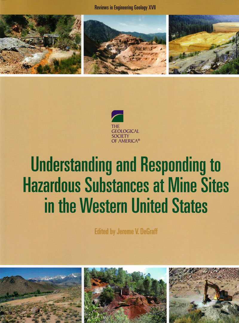
Review of Engineering Geology 17 - Understanding and Responding to Hazardous Substances at Mine Sites in the Western United States
Description:
DeGraff, J. V. / UNDERSTANDING AND RESPONDING TO HAZARDOUS SUBSTANCES AT MINE SITES IN THE WESTERN UNITED STATES, Boulder, 2007, pb, 181 pages, $ 25
This volume documents interesting approaches, techniques, and practical scientific considerations associated with mine site remediation. It also highlights how various federal, state, and local agencies and organizations are trying to bring the best science possible to bear on this serious problem. Some chapters focus on specific methods for characterization, particular contaminant issues, and impacts from the release of hazardous substances from mine and mill sites. Others describe successful response actions, technologies, or practical approaches for addressing contaminant releases to the environment.
Contents:
1. Addressing the toxic legacy of abandoned mines on public land in the western United States
2. Characterizing infiltration through a mine-waste dump using electrical geophysical and tracer-injection methods, Clear Creek County, Colorado
3. Strategies to predict metal mobility in surficial mining environments
4. The effects of acidic mine drainage from historical mines in the Animas River watershed, San Juan County, Colorado — What is being done and what can be done to improve water quality?
5. Mining-impacted sources of metal loading to an alpine stream based on a tracer-injection study, Clear Creek County, Colorado
6. On-site repository construction and restoration of the abandoned Silver Crescent lead and zinc mill site, Shoshone County, Idaho
7. Approaches to contamination at mercury mill sites: Examples from California and Idaho
8. Approaches to site characterization, reclamation of uranium mine overburden, and neutralization of a mine pond at the White King–Lucky Lass mines site near Lakeview, Oregon
9. Passive treatment of acid rock drainage from a subsurface mine
10. Management of mine process effluents in arid environments
11. Sampling and monitoring for closure

Review of Engineering Geology 15 - Catastrophic Landslides: Effects, Occurrence, and Mechanisms
Description:
Evans, S. G. and DeGraff, J. V. / CATASTROPHIC LANDSLIDES: EFFECTS, OCCURRENCE, AND MECHANISMS, GSA Reviews in Engineering, Volume XV, Boulder, 2002, cl, 412 pages, - 1 -, $ 49
This volume documents further advances in our knowledge of catastrophic landslides since the pioneering compilations of the late 1970s by Barry Voight. It provides a worldwide survey of catastrophic landslide events written by leading authorities. Catastrophic Landslides begins by drawing upon South America to dramatically illustrate the impact of these phenomena on human populations. The occurrence of catastrophic landslides, including site-specific insights, is shown through six events of the past 20 years. Several other chapters focus on the mechanisms involved with catastrophic landsides both in relation to geologic factors in a particular geographic area as well as to specific geologic processes.
Contents:
Effects
1. Overview of catastrophic landslides of South America in the twentieth century
Occurrence
2. Recent rockfalls and rock avalanches in Mount Cook National Park, New Zealand
3. Val Pola rock avalanche of July 28, 1987, in Valtellina (Central Italian Alps)
4. Tsao-Ling rockslides, Taiwan
5. Identifying a large landslide with small displacements in a zone of coseismic tectonic deformation: The Villa del Monte landslide triggered by the 1989 Loma Prieta, California, earthquake
6. Rock avalanche and resulting debris flow in Estero Parraguire and Río Colorado, Región Metropolitana, Chile
7. 1983 Sale Mountain landslide, Gansu Province, China
Mechanisms
8. Catastrophic rockfalls and rockslides in the Sierra Nevada, USA
9. Rapid flow slides of coal-mine waste in British Columbia, Canada
10. Landslides resulting from structural failure of volcanoes
11. Large rockslides in the Alps: A commentary on the contribution of G. Abele (1937-1994) and a review of some recent developments
12. Chalk flows from the coastal cliffs of northwest Europe
13. Villavil rockslides, Catamarca Province, Argentina
14. Landslides and landscape evolution in the Rocky Mountains and adjacent Foothills area, southwestern Alberta, Canada
15. Styles of rock-avalanche depositional complexes conditioned by very rugged terrain, Karakoram Himalaya, Pakistan
16. Neogene sturzstrom deposits, Split Mountain area, Anza-Borrego Desert State Park, California

Review of Engineering Geology 6 - Man-induced land subsidence
Description:
Holzer, T. L., Ed. / MAN-INDUCED LAND SUBSIDENCE, Reviews in Engineering Geology, Volume VI, Boulder, 1984, cl, 221 pages, - 2 -, $ 45
Land subsidence has been caused by man's activities in at least 37 of the 50 U.S. states and affects more than 40,000 square kilometers in the United States alone. These nine papers, dedicated to Joseph Fairfield Poland's life work, constitute a major contribution to measuring and understanding this probelm. They are arranged in three categories: (1) fluid withdrawal from porous media; (2) drainage of organic soil; and (3) collapse into man-made and natural cavities.
Contents:
1. Field-based computational techniques for predicting subsidence due to fluid withdrawal
2. Subsidence over oil and gas fields
3. Subsidence due to geothermal fluid withdrawal
4. Ground failure induced by ground-water withdrawal from unconsolidated sediment
5. Organic soil subsidence
6. Coal mine subsidence-eastern United States
7. Coal mine subsidence-western United States
8. inkholes resulting from ground-water withdrawal in carbonate terranes-an overview
9. Mechanisms of surface subsidence resulting from solution extraction of salt

Review of Engineering Geology 12 - A paradox of power: voices of warning and reason in the geosciences
Description:
Welby, C. W. and Gowan, M. E., Ed. / A PARADOX OF POWER: VOICES OF WARNING AND REASON IN THE GEOSCIENCES, GSA Reviews in Engineering Geology, Volume XII, Boulder, 1988, cl, 184 pages, - 2 -, $ 35
The 13 papers in this volume illustrate issues and opportunities confronting geologists as they bring their knowledge and understanding to bear in matters related to public health and welfare. Public decisions and decision-making processes in the face of geologic complexity and uncertainty are the subject of the first group of papers. In the second group, several "voice of warning" papers illustrate the use of geologic knowledge and research to warn the public of health hazards derived from geologic materials and processes. A third group of papers, in the "voice of reason" section, describes use of geologic knowledge to help lower the costs of mitigation and avoidance of geologic hazards. Finally, ethical and philosophical questions confronting geoscientists are discussed and issues of "truth" as related to the legal process and questions about the adequacy of information in making decisions about long-term radioactive waste disposal are discussed
Contents:
1. The dilemma of the geologist: Earth resources and environmental policy
2. Resolving environmental complexity: A geologic appraisal of process-response elements and scale as controls of shoreline erosion along southeastern Lake Ontario, New York
3. Colonial impacts to wetlands in Lebanon, Connecticut
4. Robert M. Thorson, Andrew G. Harris, Sandra L. Harris, Robert Gradie III, and M. W. Lefor
5. Presentation of radon potential maps to the public: A case history for Portland, Oregon
6. An outbreak of coccidioidomycosis (valley fever) caused by landslides triggered by the 1994 Northridge, California, earthquake
7. Sewage sludge (biosolids) land disposal in a southeastern U.S. Piedmont setting: Ground-water pollution potential
8. Seismic microzonation in the Pacific Northwest, with an example of earthquake hazard mapping in southwest British Columbia
9. Asbestos monitoring and regulation in public drinking-water supplies: A case history from North Carolina
10. Evaluating debris-flow hazards in Davis County, Utah: Engineering versus geological approaches
11. Preliminary assessment of the seismicity of the Malibu Coast Fault Zone, southern California, and related issues of philosophy and practice
12. Glacial geology, law, and the Love Canal trial
13. Expectations of geological science: Yucca Mountain site characterization, Nevada
14. Providing valid long-term projections of geologic systems for policy decisions: Can we succeed? Should we try?

Review of Engineering Geology 14 - The Environmental Legacy of Military Operations
Description:
Hatheway, A. W. / THE ENVIRONMENTAL LEGACY OF MILITARY OPERATIONS, GSA / Reviews in Engineering Geology, Volume XIV, 2001, cl, 228 pages, - 2 -, has GSA Stamps, overwise mint, $ 39
The 14 chapters in this book about military geology comprises research and practical efforts directed toward providing geological input for military construction, civil works projects, remediation of polluted military facilities, terrain analysis, sustainability of training lands, mobility prediction, and site characterization activities. Land use sustainability issues, base closures, and heightened levels of environmental awareness by the general public have introduced new challenges for using, maintaining, cleaning, and restoring lands that have served as military installations for decades. In this volume, the legacy of military operations and their impact on the terrain and geology, particularly from an environmental viewpoint, are considered by geologists of diverse lands and backgrounds.
Contents:
1. Introduction
2. Terrain evaluation for peacekeeping with examples from Bosnia Herzegovina
3. Quantifying terrain fabric in digital elevation models
4. Methodology for remote characterization of fracture systems in bedrock of enemy underground facilities
5. Predicting fracture properties in weathered granite in denied areas
6. Battlefield terrain and engineering geology in the eastern Chorwon Valley, central Korean Peninsula
7. Military engineering on the Rock of Gibraltar and its geoenvironmental legacy
8. Fifty-four years of ephemeral channel response to two years of intense World War II military activity, Camp Iron Mountain, Mojave Desert
9. Wetlands and erosion studies in support of military training, Camp Shelby Training Site, Mississippi
10. Sustainability of military lands: Historic erosion trends at Fort Leonard Wood, Missouri
11. Freeze-thaw induced geomorphic and soil changes in vehicle ruts and natural rills
12. Unsurfaced road investigation and management plan, Fort Leonard Wood, Missouri
13. Geology without borders: A conceptual model for Aberdeen Proving Ground
14. Geoenvironmental factors in the regeneration of military airfields in Great Britain
End of this GSA Publications Catalog!
Click any link to continue.
GSA Memoirs
Special Papers
Our regular stock of older GSA Publications < More Memoirs, Special Papers, and Reviews of Engineering Geology can be found in this catalog
GSA DNAG (Decade of North American Geology) Publications
Home Page
Catalogs on this Website
Mineral Specimens
Mining History
U.S. State Geology
USGS Publications
Ore Deposits
Paleontology Books